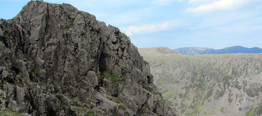
Slab and Notch is the shortest and most accessible route to the summit of Pillar Rock. However, it is a Grade 3 scramble (or Moderate rock climb) with considerable exposure so may be best done roped. If so, some large slings and screwgate carabiners plus a few nuts and a couple of extendable quickdraws are handy. Take some tat if you fancy an abseil descent.
Grade: 3
Start/Finish: Wasdale Head Inn (Maps link)
Route Map
Approach
Obvious direct approaches can be made to Pillar Rock from Ennerdale, but an interesting approach can also be made from Wasdale Head which is described below.
From the Wasdale Head Inn, go between the Inn and the Barn Door Shop and follow the beck past the old bridge to a gate where the path to Black Sail Pass bears left, initially following a wall. Follow this path all the way to Black Sail Pass, crossing and recrossing Gatherstone Beck en route.
At the pass, turn left and take a choice of traversing paths over or around Looking Stead to a col. Ascend slightly beyond this to a small cairn marking the start of the High Level Traverse which turns right off the ridge path at this point. Follow this path (faint in places) to Robinson’s Cairn for views of Pillar Rock.
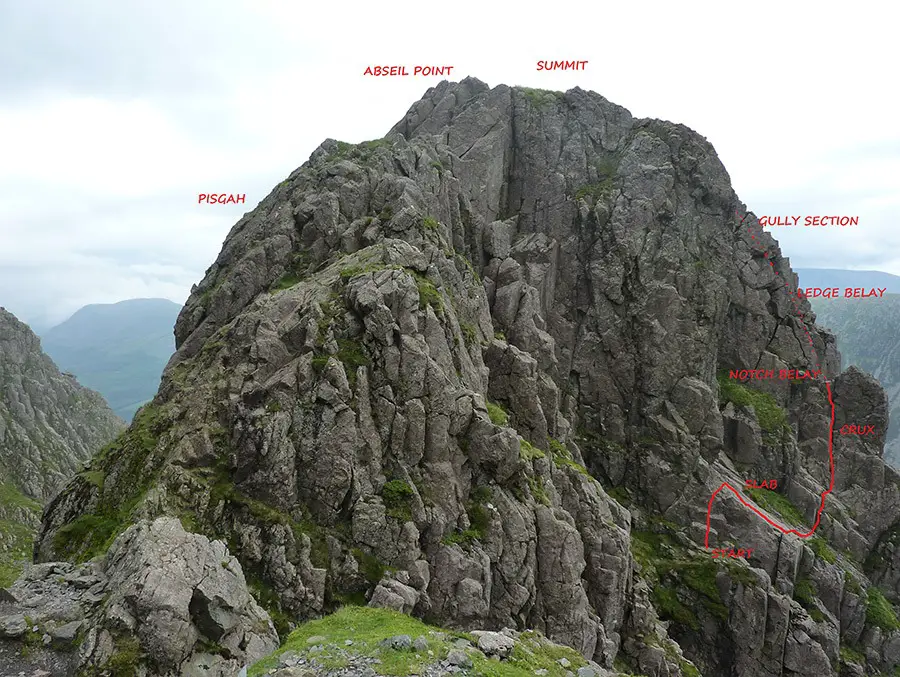
Continue towards your objective and cross scree at a depression to reach a series of rising zigzags in scree, beyond which is the ascending Shamrock Traverse. This section requires care if icy or wet. As you approach via this airy pathway, you should be able to pick out the prominent Slab and the Notch above and to the right.
Just before reaching Pillar Rock, leave the main path and descend slightly to cross a series of buttresses to a ledge which marks the start of the route.
The Scramble
If doing the route roped, tie in and rack up at a ledge below some easy steps. Go up these to reach the upper left corner of an easy angled slab.
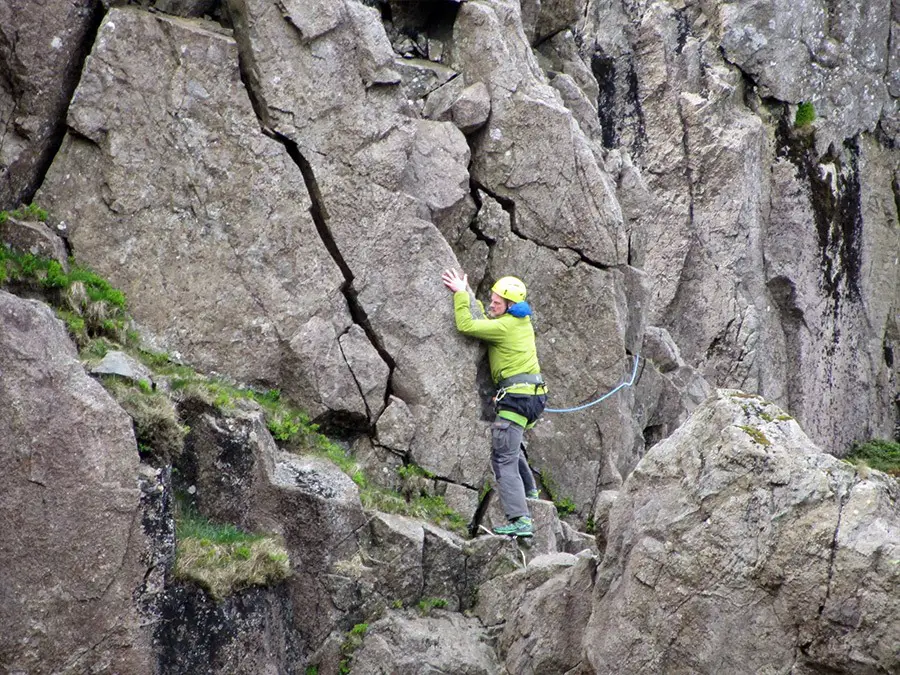
Descend along the edge of the Slab to a horizontal crack at it’s lower end where it is easiest to cross to the right. Arrange some protection to protect your second from a swing in the event of a slip and continue up a small step to a wall with vertical cracks. The rightmost has wear and the holds are rounded but positive (although beware a wobbly spike) and lead to an airy belay above this crux section (slings over blocks here provide solid anchors).
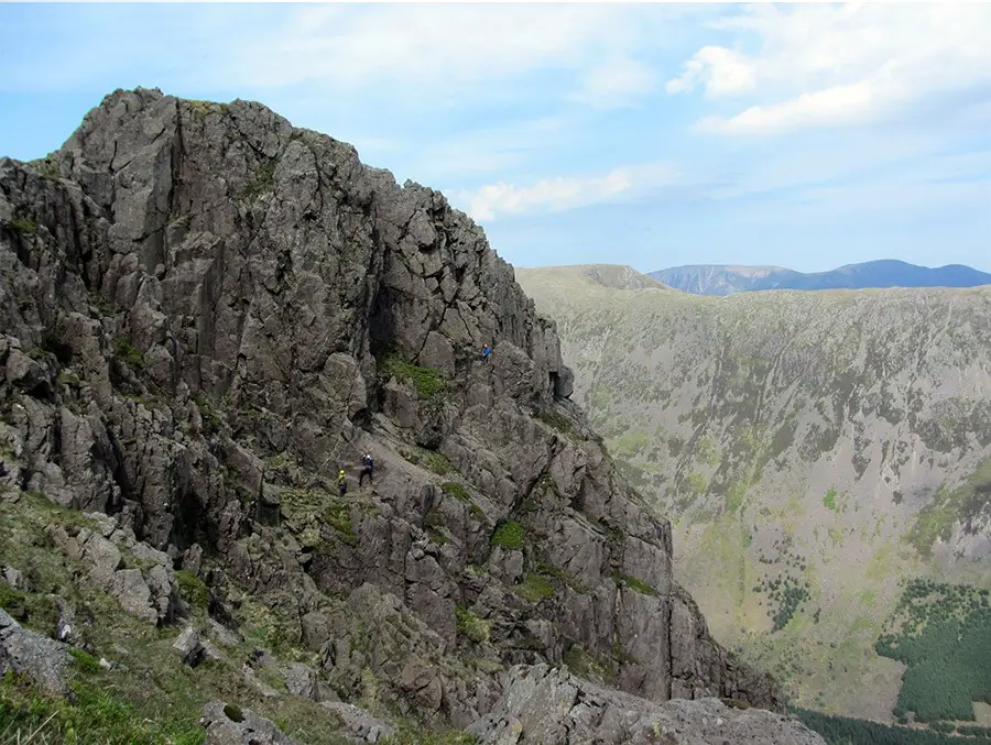
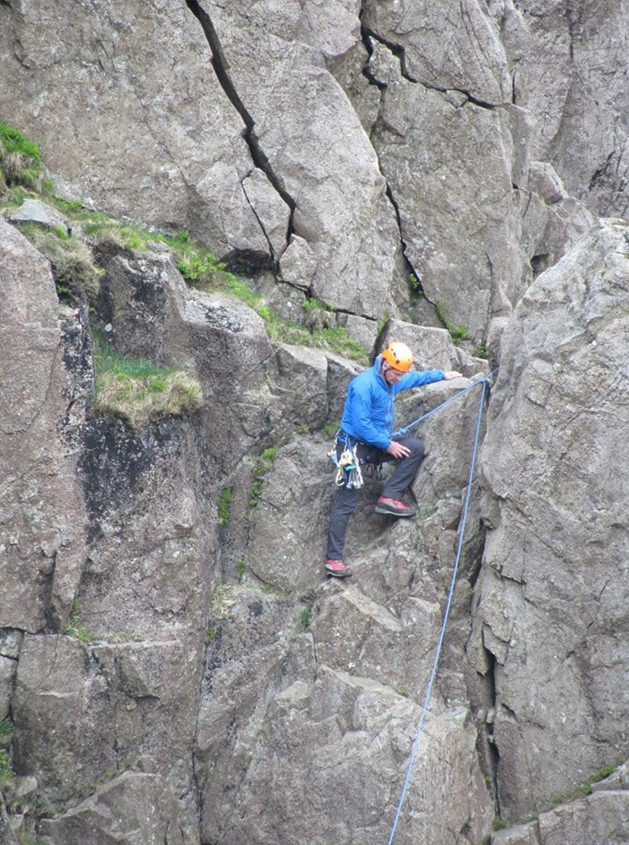
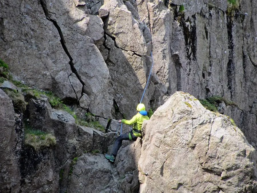
From here step around to the right on a ledge and climb up a short broken wall/arete to a large and comfortable ledge where a thread belay can be arranged while peering down on your second at the Notch. Step right again and ascend slabs in a rising rightwards traverse in a broad gully which narrows at the top.
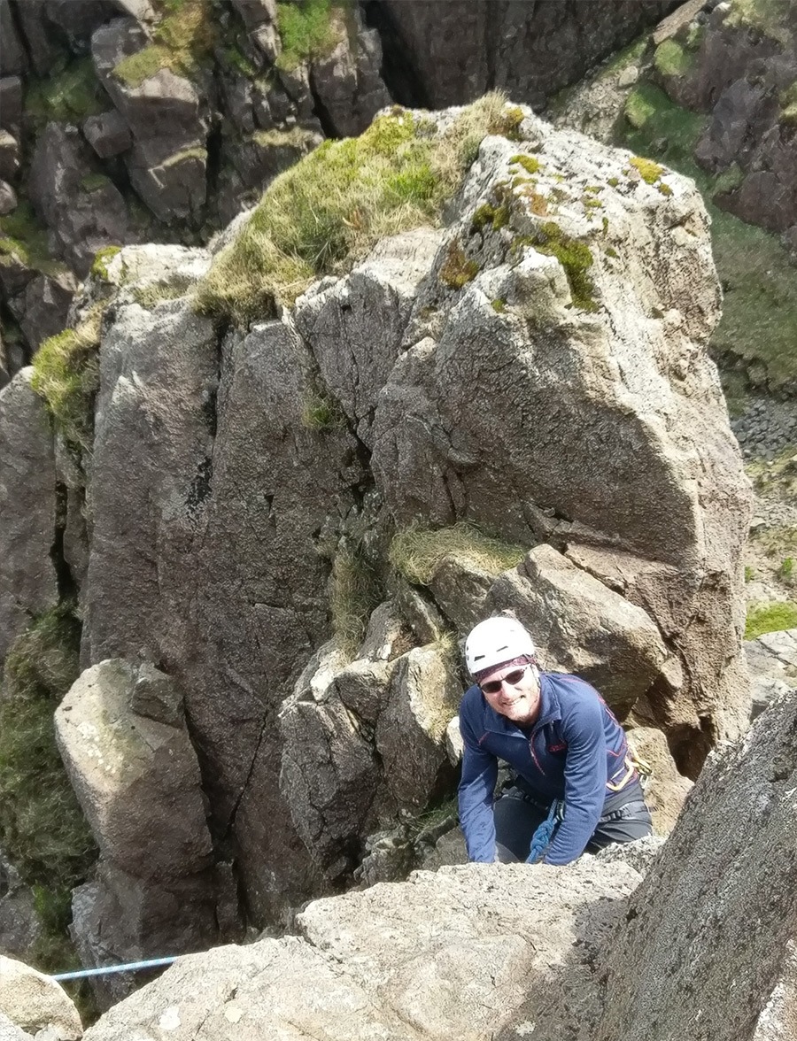
Another thread belay can be arranged beside a block in a cleft but only easy scrambling remains up the narrow gully (top part of the Great Chimney) to the summit, so you might choose to continue to the top instead.
Descent
Just beyond the summit cairn and above Jordan Gap, abseil tat can usually be found but a few metres of accessory cord and a maillon or screwgate may be useful here. An abseil
into the gap followed by a scramble back to the start completes the route. Alternatively the route can be downclimbed straightforwardly but with care. Some parties leave a sling or cord loop at the Notch belay to protect the last climber down the crux section.
Continuation
A brief foray onto the mini summit of Pisgah (G1) followed by an ascent of Pillar by the obvious path is a natural continuation. Return either by the ridgeline descent to Black Sail Pass, or more sportingly and if time allows, by continuing round the Mosedale Horseshoe to Little Scoat Fell (diversion to Steeple and back), Red Pike and Yewbarrow via the scrambly Stirrup Crag, to reach the lakeside road at Overbeck Bridge Car Park.
Recommended Guidebook & Map
The best guidebook for this route is found in the Cicerone guide Scrambles in the Lake District North, available via Paperback or Kindle Book on Amazon here.
It can also be found in the Wired Guides – Lake District Rock (page 261).
The route is also described in descent in:
- Vertebrate Publishing – Lake District Climbs and Scrambles
- Grey Stone Books – Scrambles and Easy Climbs in the Lake District
The map for this route is the Ordinance Survey OL6, The English Lakes, South-Western Area (including the Ennerdale approach), available on Amazon here.
For the Wasdale approach, the Ordnance Survey OL4 – The English Lakes North-Western Area, available on Amazon here.
Recommended Scrambling Guide: (coming soon)
Best Accommodation
You can find local accommodation on Booking.com here.
Route Info
| Distance | 18.3 km |
| Elevation | 1111m +/- |
| Duration | 8 hours |
| Grade | 3 |
| Transport | Car - Wasdale Head Inn |
Navigation
| Guidebook | Best Book |
| Maps | Best Map |
| Guided Tours | Guides |
| Accommodation | Where To Stay? |
| Contributor | Who Contributed? |
Route Contributed by: John Walker
BIO: I subscribe to Alex Lowe’s adage that “the best climber in the world is the one having the most fun”.
Facebook: https://www.facebook.com/john.walker.3726
This route was created by John Walker and donated to the UK Scrambles website through our contributor program.
This generosity enables us to publish a whole range of scrambling routes to help you enjoy the outdoors.
If you have a route you could contribute, submit it to us today.
